My Genealogy Hound
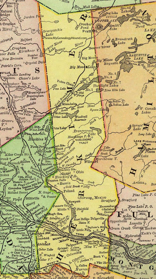
Herkimer County, New York 1897 Map

Locations shown include: Beaver River * Big Moose * Cedar Lake * Cedarville * Cedarville Station * Cold Brook * Columbia * Cullen * Danube P O * Dolgeville * East Schuyler P O * East Winfield * Eatonville * Fairfield * Fenners Grove * Frankfort * Frankfort Hill * Fulton Chain * Grant * Gravesville * Gray * Harbor * Herkimer * Hinckley P O * Hinckley Station * Hommedaga P O * Ilion * Indian Castle * Ingham's Mills * Jacksonburg * Jordanville * Kast Bridge * Litchfield * Little Falls * McKeever * Mexico * Middleville * Miller's Mills * Minnehaha * Mohawk * Newport * Newville * North Litchfield * North Winfield * Northwood * Norway * Ohio * Old Forge * Otter Lake * Paines Hollow * Poland * Russia * Salisbury * Salisbury Center * Sheafs Corners * South Columbia * Spinnerville * Starkville * Van Hornesville * Warren * West Schuyler * West Winfield * Wilmurt * Winfield P O *
This Herkimer County map is a portion of an 1897 New York map by Rand McNally.
View additional New York Maps here: New York County Maps
County maps from other states can be viewed here: State County Maps
Use the links at the top right of this page to search or browse thousands of family biographies.