My Genealogy Hound
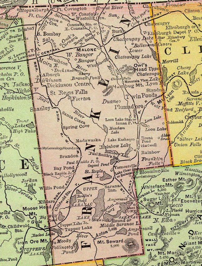
Franklin County, New York 1897 Map

Locations shown include: Alburgh * Alder Brook * Algonquin * Ampersand * Axton * Bangor * Bangor Station * Bartlett Carry * Bay Pond * Bellemont Centre * Black Rapids Junction * Bombay * Brandon * Brushton * Burke * Chasm Falls * Chateaugay * Chateaugay Lake * Childwolds Station * Constable Station * Cook's Corners * Dickinson * Dickinson Centre * Duane * East Constable P O * East Dickinson * Fort Covington * Fort Covington Center * Franklin Falls * Goldsmith * Harriettstown * Hartwell * Hogansburgh * Inman P O * Kildare * Lake Clear Junction * Lake Kushaqua * Loon Lake * Loon Lake Station * Madawaska * Malone * Malone Junction * Moira * Moody * Mountain View * North Bangor P O * Owls Head * Paul Smiths P O * Paul Smiths Station * Plumadore * Rainbow * Rainbow Lake * Round Pond * Saint Regis Falls * Salmon * Santa Clara * Saranac Inn * Saranac Junction * Saranac Lake * Shanley * South Bombay * Spring Cover * Sun * Thayer's Corners * Trout River * Tupper Lake * Tupper Lake Junction * Twin Ponds * Vermontville * West Bangor * West Constable * Westville Center * Whippleville * Willis Pond * Wolf Pond *
This Franklin County map is a portion of an 1897 New York map by Rand McNally.
View additional New York Maps here: New York County Maps
County maps from other states can be viewed here: State County Maps
Use the links at the top right of this page to search or browse thousands of family biographies.