My Genealogy Hound
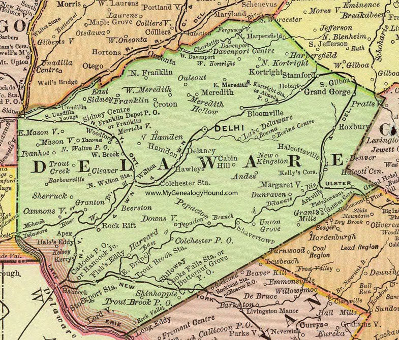
Delaware County, New York 1897 Map

Locations shown include: Alameda P O * Andes * Apex * Arkville * Barbourville * Beerston * Bloomville * Bovina * Bovina Centre * Butternut Grove P O * Cabin Hill * Cadosia P O * Cannonsville * Chiloway * Colchester P O * Colchester Station * Cooks Falls Station * Croton * Davenport * Davenport Centre * Delancy * Delhi * Downsville * Dunraven * East Branch * East Masonville * East Meredith * East Sidney * Fergusonville * Fish's Eddy * Fleischmanns * Franklin * Franklin Depot P O * Grand Gorge * Granton * Grant's Mills * Griffin's Corners * Halcottsville * Hale's Eddy * Hamden * Hancock * Hancock Junction * Harpersfield * Harvard * Hawleys * Hobart * Ivanhoe * Kelly's Corners * Kelsey * Kerrys * Kortright * Lake Delaware * Lordville * Margaretville * Masonville * Meredith * Meredith Hollow * Merricksville * New Kingston * North Franklin * North Hamden * North Harpersfield * North Walton Station * Ouleout * Pepacton * Rock Rift * Rock Valley * Roxbury * Shavertown * Sherruck * Shinhopple * Sidney Centre * South Kortright Station * South Unadilla * Stamford * Stockport Station * Tacoma * Trout Brook P O * Trout Brook Station * Trout Creek * Union Grove * Walton * West Davenport * West Kortright * West Meredith * Woodford * Youngs *
This Delaware County map is a portion of an 1897 New York map by Rand McNally.
View additional New York Maps here: New York County Maps
County maps from other states can be viewed here: State County Maps
Use the links at the top right of this page to search or browse thousands of family biographies.