My Genealogy Hound
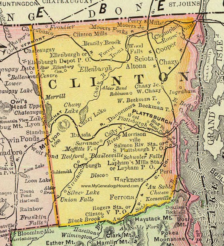
Clinton County, New York 1897 Map

Locations shown include: Alder Bend * Altona * Au Sable * Au Sable Chasm * Beekmantown * Black Brook * Bluff Point Station * Brandy Brook * Cadyville * Champlain * Chazy * Chazy Junction * Chazy Lake * Churubusco * Clayburgh * Clintonville P O * Cooper * Cumberland Head * Dannemora * Disco * East Beekmantown * Ellenburgh * Ellenburgh Center * Ellenburgh Depot P O * Ferrona * Forest * Frontier * Harkness * Hotel Champlain P O * Ingraham * Irona * Keeseville * Lapham Mills Station * Lapman P O * Merrill * Moffittsville * Mooers Forks * Mooers Junction * Morrisonville * Peasleeville * Perrys Mills * Peru * Plattsburgh * Redford * Robinson * Rogers Station * Rouses Point * Russia * Salmon River Station * Saranac * Schuyler Falls * Sciota * Silver Lake * South Plattsburgh P O * Star * Union Falls * West Beekmantown * West Chazy * West Plattsburgh * Wood Falls *
This Clinton County map is a portion of an 1897 New York map by Rand McNally.
View additional New York Maps here: New York County Maps
County maps from other states can be viewed here: State County Maps
Use the links at the top right of this page to search or browse thousands of family biographies.