My Genealogy Hound
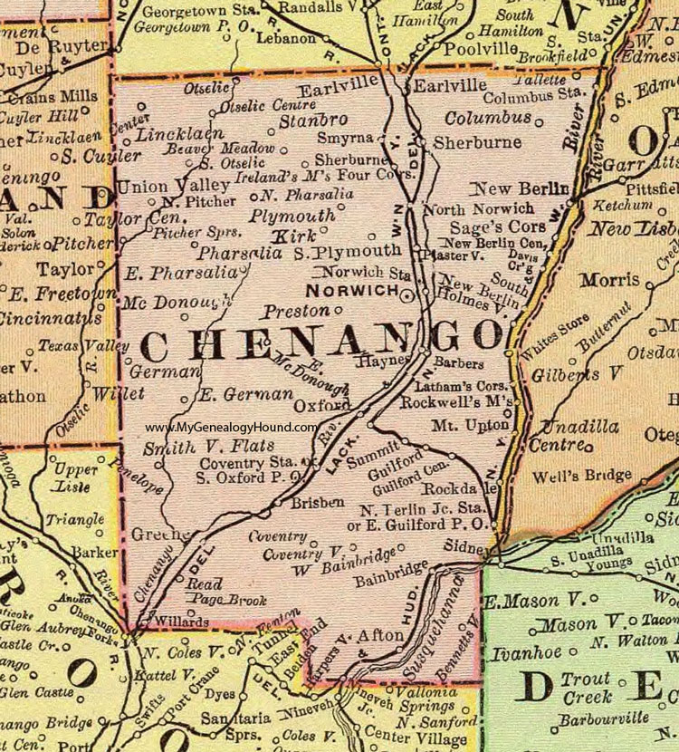
Chenango County, New York 1897 Map

Locations shown include: Afton * Bainbridge * Barbers * Beaver Meadow * Bennettsville * Brisben * Chenango * Columbus * Columbus Station * Coventry * Coventry Station * Coventryville * Davis Crossing * Earlville * East German * East Guilford P O * East Pharsalia * German * Greene * Guilford * Guilford Center * Haynes * Holmesville * Ireland's Mills * Kirk * Lathams Corners * Lincklaen * Lincklaen Center * McDonough * Mount Upton * New Berlin * New Berlin Center * New Berlin Junction Station * Nineveh Junction * North Norwich * North Pharsalia * North Pitcher * Norwich * Norwich Station * Otselic * Otselic Centre * Oxford * Pharsalia * Pitcher Springs * Plasterville * Plymouth * Preston * Read Page Brook * Rockdale * Rockwells Mills * Sages Corners * Sherburne * South New Berlin * South Otselic * South Oxford P O * Smithville Flats * Smyrna * South Plymouth * Stanbro * Summit * Tallette * Union Valley * West Bainbridge * Whites Store * Willards *
This Chenango County map is a portion of an 1897 New York map by Rand McNally.
View additional New York Maps here: New York County Maps
County maps from other states can be viewed here: State County Maps
Use the links at the top right of this page to search or browse thousands of family biographies.