My Genealogy Hound
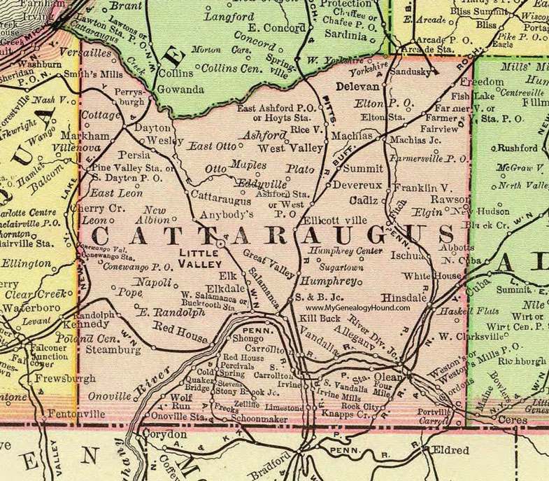
Cattaraugus County, New York 1897 Map

Locations shown include: Abbotts * Allegany * Anybody's * Ashford * Ashford Station * Bucktooth Station * Cadiz * Carroll * Carrollton * Cattaraugus * Cold Spring * Conewango P O * Conewango Station & Conewango Valley * Cottage * Dayton * Delevan * Devereux * East Ashford P O * East Leon * East Otto * East Randolph * Eddyville * Elgin * Elk * Elkdale * Ellicottville * Elton P O * Elton Station * Fairview * Farmersville * Farmersville P O * Farmersville Station * Fish Lake * Four Mile * Franklinville * Frecks * Freedom * Gordons * Gowanda * Great Valley * Haskell Flats * Hinsdale * Hoyts Station * Humphrey * Humphrey Center * Irvine * Irvine Mills * Ischua * Kill Buck * Knapps Creek * Leon * Limestone * Little Valley * Machias * Machias Junction * Maples * Markham * Napoli * New Albion * Olean * Onoville * Onoville Station * Otto * Percivals * Perrysburgh * Persia * Pine Valley Station * Plato * Pope * Portville * Quaker Bridge * Randolph * Rawson * Red House * Riceville * Riverside Junction * Rock City * S & B Junction * Salamanca * Sandusky * Schoonmaker * Shongo * South Carrollton * South Dayton P O * South Vandalia * Steamburg * Stevens * Stony Brook Junction * Sugartown * Summit * Vandalia * Versailles * Summit * Wesley * Weston's * Weston's Mills P O * West P O * West Salamanca * West Valley * West Yorkshire * White House * Wolf Run * Yorkshire * Zeiliffe *
This Cattaraugus County map is a portion of an 1897 New York map by Rand McNally.
View additional New York Maps here: New York County Maps
County maps from other states can be viewed here: State County Maps
Use the links at the top right of this page to search or browse thousands of family biographies.