My Genealogy Hound
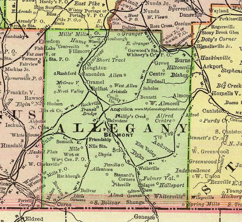
Allegany County, New York 1897 Map

Locations shown include: Alfred * Alfred Centre * Allen * Allentown * Alma * Almond * Andover * Angelica * Aristotle * Belfast * Belmont * Belvidere * Bennett * Birdsall * Bishopville * Black Creek * Bolivar * Bowlers * Burns * Canaseraga * Caneadea * Centre * Centreville * Ceres * County Home * Cuba * Dyke * East Granger * Elm Valley * Fillmore * Friendship * Fulmer Valley * Garwood's Station * Granger * Grove * Groves * Hallsport * Hiltonville * Houghton * Independence * Little Genesee * Mapes * McGrawville * Mills' Mills * New Hudson * Nile * Nile Station * North Cuba * North Valley * Oramel * Petrolia * Phillip's Creek * Pikeville * Richburgh * Rockville * Rossburgh * Rushford * Scholes * Scio * Shongo * Short Tract * South Bolivar * Spring Mills * Stanard's Corners (Stannards) * Stone Dam * Summit * Swain P O * Swains Junction * Tip Top * Transit Bridge * Utopia * Wellsville * West Allen * West Almond * West Clarksville * Whitesville * Whitney's Crossing P O * Wirt * Wirt Center P O * Wiscoy *
This Allegany County map is a portion of an 1897 New York map by Rand McNally.
View additional New York Maps here: New York County Maps
County maps from other states can be viewed here: State County Maps
Use the links at the top right of this page to search or browse thousands of family biographies.