My Genealogy Hound
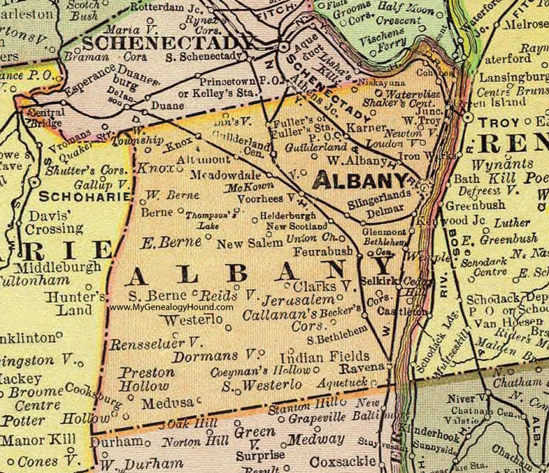
Albany County, New York 1897 Map

Locations shown include: Albany * Altamont * Aquetuck * Becker's Corners * Berne * Bethlehem Center * Callanan's Corners * Cedar Hill * Clarksville * Coeyman's Hollow * Cohoes * Cooksburg * Delmar * Dormansville * Dunnsville * East Berne * Feurabush * Fuller's * Fuller's Station P O * Glenmont * Guilderland * Guilderland Center * Helderburgh * Indian Fields * Jerusalem * Karner * Knox * Loudonville * McKown * Meadowdale * Medusa * New Salem * New Scotland * Newtonville * Niskayuna * Potter Hollow * Preston Hollow * Ravena * Reidsville * Rensselaerville * Selkirk * Shaker's Center * Slingerlands * South Berne * South Bethlehem * South Westerlo * Thompson's Lake * Union Church * Voorheesville * Watervliet * Wemple * West Albany * West Berne * Westerlo * West Township * West Troy *
This Albany County map is a portion of an 1897 New York map by Rand McNally.
View additional New York Maps here: New York County Maps
County maps from other states can be viewed here: State County Maps
Use the links at the top right of this page to search or browse thousands of family biographies.