My Genealogy Hound
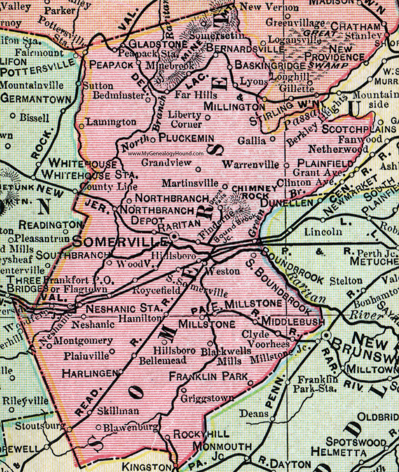
Somerset County, New Jersey, 1905 Map

Locations shown include: Baskingridge (Basking Ridge), Bedminster, Bellemead, Bernardsville, Blackwells Mills, Blawenburg, Boundbrook (Bound Brook), Bound Brook Junction, Clyde, Depot Falls, East Millstone, Far Hills, Finderne, Flagtown, Frankfort P O, Franklin Park, Gallia, Gladstone, Grandview, Griggstown, Hamilton, Harlingen, Hillsboro, Larnington, Liberty Corner, Lyons, Martinsville, Middlebush, Millstone, Minebrook (Mine Brook), Montgomery, Neshanic, Neshanic Station, Northbranch (North Branch), Northbranch Depot (North Branch Depot), Peapack, Peapack Station, Plainville, Pluckemin, Raritan, Rocky Hill, Roycefield, Skillman, Somersetin, Somerville, South Boundbrook (South Bound Brook), Southbranch (South Branch), South Somerville, Voorhees, Warrenville, West Neshanic, Weston, Woodfern, Woodville.
This Somerset County map is a portion of a 1905 New Jersey map by George F. Cram.
View additional New Jersey Maps here: New Jersey County Maps
County maps from other states can be viewed here: State County Maps
Use the links at the top right of this page to search or browse thousands of family biographies.