My Genealogy Hound
Wilson County, Tennessee 1888 Map
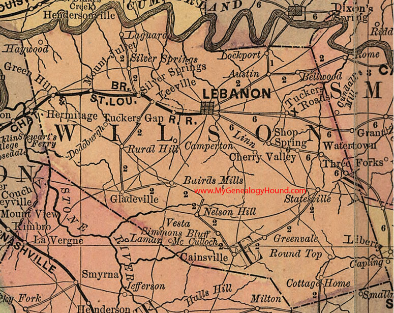
Locations shown include: Austin, Bairds Mills, Bellwood, Cainsville, Camperton, Cherry Valley, Cottage Home, Dodoburgh, Gladeville, Green Hill, Greenvale, Haywood, Iaguardo, Lebanon, Leeville, Linn, Lockport, McCulloch, Mount Juliet, Nelson Hill, Round Top, Rural Hill, Shop Spring, Silver Springs, Simmons Bluff, Statesville, Three Forks, Tuckers Gap, Tuckers Roads, Vesta, Watertown
This a portion of a Tennessee map by Rand, McNally & Co. 1882, 1888
View additional Tennessee Maps here: Tennessee County Maps
County maps from other states can be viewed here: State County Maps
Additional Wilson County resources: Wilson County, Tennessee History and Genealogy
Use the links at the top right of this page to search or browse thousands of family biographies.