My Genealogy Hound
Roane County, Tennessee 1888 Map
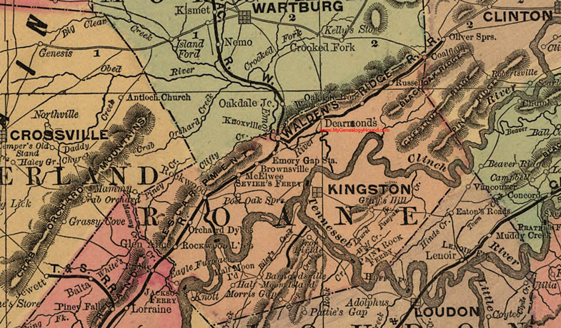
Locations shown include: Brownsville, Coalfield, DeArmond (Dearmond's), Eagle Furnace, Emory Gap Station, Glen Alice, Gray's Hill, Half Moon Island, Iron Divide, Jackson's Ferry, Kingston, Knott, McElwee, Morris Gap, Oakdale Iron Works, Orchard Dykes, Paint Rock Ferry, Post Oak Springs, Rockwood, Rockwood Landing, Russell, Sevier's Ferry
This a portion of a Tennessee map by Rand, McNally & Co. 1882, 1888
View additional Tennessee Maps here: Tennessee County Maps
County maps from other states can be viewed here: State County Maps
Additional Roane County resources: Roane County, Tennessee History and Genealogy
Use the links at the top right of this page to search or browse thousands of family biographies.