My Genealogy Hound
Johnson County, Tennessee 1888 Map
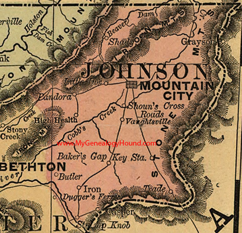
Locations shown include: Baker's Gap, Butler, Casper, High Health, Iron, Key Station, Little Doe, Mountain City, Pandora, Shady, Shoun's Cross Roads, Stamp Knob, Trade, Vaughtsville
This a portion of a Tennessee map by Rand, McNally & Co. 1882, 1888
View additional Tennessee Maps here: Tennessee County Maps
County maps from other states can be viewed here: State County Maps
Additional Johnson County resources: Johnson County, Tennessee History and Genealogy
Use the links at the top right of this page to search or browse thousands of family biographies.