My Genealogy Hound
Greene County, Tennessee 1888 Map
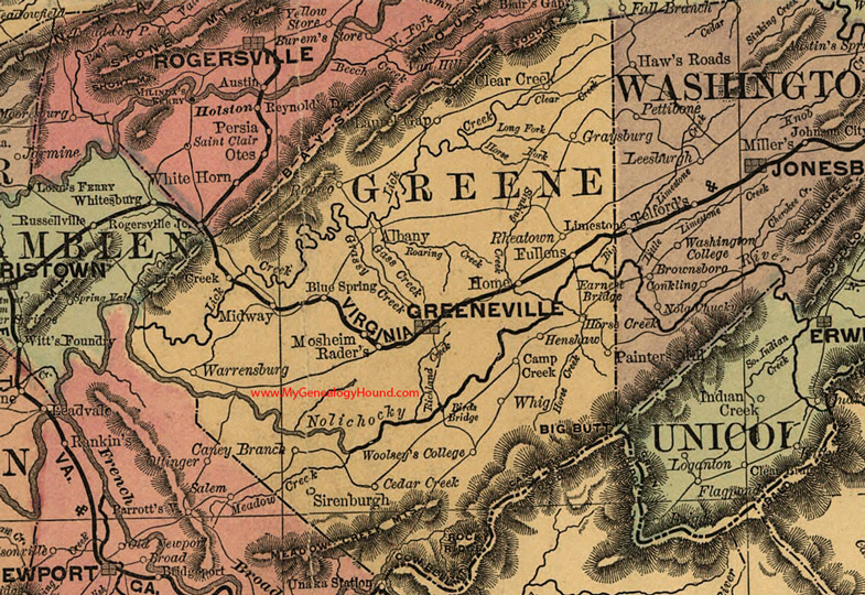
Locations shown include: Albany, Birds Bridge, Blue Spring, Camp Creek, Caney Branch, Cedar Creek, Clear Creek, Earnest Bridge, Fullens, Graysburg, Greeneville, Henshaw, Home, Laurel Gap, Lick Creek, Midway, Mosheim, Painters Mill, Rader's, Rheatown, Romeo, Sirenburgh, Warrensburg, Whig, Woolsey's College
This a portion of a Tennessee map by Rand, McNally & Co. 1882, 1888
View additional Tennessee Maps here: Tennessee County Maps
County maps from other states can be viewed here: State County Maps
Additional Greene County resources: Greene County, Tennessee History and Genealogy
Use the links at the top right of this page to search or browse thousands of family biographies.