My Genealogy Hound
Clay County, Tennessee 1888 Map
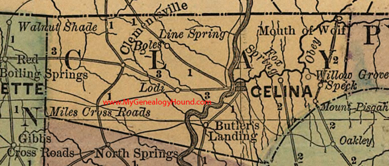
Locations shown include: Boles, Butler's Landing, Celina, Clementsville, Line Spring, Lodi, Miles Cross Roads, Mount Pisgah, Mouth of Wolf, Speck, Willow Grove
This a portion of a Tennessee map by Rand, McNally & Co. 1882, 1888
View additional Tennessee Maps here: Tennessee County Maps
County maps from other states can be viewed here: State County Maps
Use the links at the top right of this page to search or browse thousands of family biographies.