My Genealogy Hound
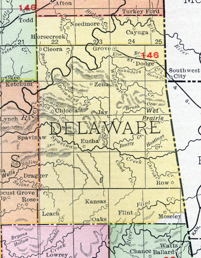
Delaware County, Oklahoma 1911 Map

Locations shown include: Cayuga, Chloeta, Cleora, Dodge, Eucha, Flint, Grove, Horsecreek, Jay, Kansas, Leach, Moseley, Needmore, Oaks, Row, Turkey Ford, Zena.
This Delaware County map is a portion of a 1911 Oklahoma map by Rand McNally.
View additional Oklahoma County and Indian Nation Maps here: Oklahoma County and Indian Nation Maps
County maps from other states can be viewed here: State County Maps
Use the links at the top right of this page to search or browse thousands of family biographies, historic maps and vintage photos and postcards.