My Genealogy Hound
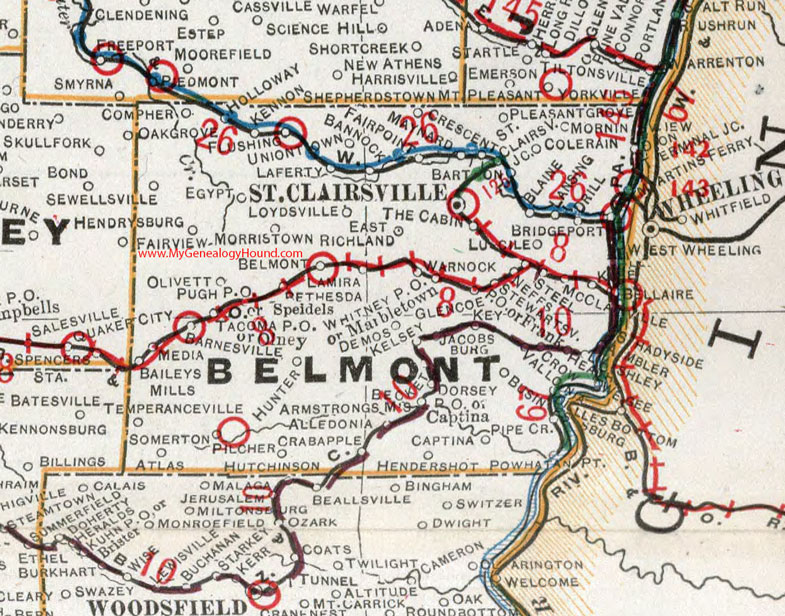
Belmont County, Ohio 1901 Map

Locations shown include: Alledonia * Ambler * Armstrongs Mills * Atlas * Baileys Mills * Bannock * Barnesville * Barton * Becket * Belmont * Bethesda * Blaine * Bridgeport * Businessburg * Captina * Clairsville Jct. * Colerain * Compher * Crabapple * Crescent * Crow * Demos * Dilles Bottom * Dorsey P O * Drill * Fairpoint * Flushing * Franklin * Glencoe * Heath * Hendershot * Holloway * Hunter * Hutchinson * Jacobsburg * Kelsey * Kennon * Key * Klee * Laferty * Lamira * Lansing * Loydsville * Lucile * Marbletown * Martins Ferry * Maynard * McClainville * Media * Morning View * Neffs * Olney * Pilcher * Pleasant Grove * Powhatan Point * St. Clairsville * Shadyside * Somerton * Speidels * Steel * Stewartsville P O * Tacoma P O * Temperanceville * Terminal Junction * The Cabin * Uniontown * Vallona * Warnock * Wegee * Whitney P O
This Belmont County map is a portion of an 1901 Ohio map by Cram.
View additional Ohio Maps here: Ohio County Maps
County maps from other states can be viewed here: State County Maps
Use the links at the top right of this page to search or browse thousands of family biographies.