My Genealogy Hound
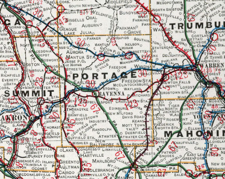
Portage County, Ohio 1901 Map

Locations shown include: Atwater * Atwater Center * Aurora * Aurora Station * Brimfield * Campbellsport * Caton P O * Charleston Station * Charlestown * Davis Road * Deerfield * Earlville * Edinburg * Freedom * Freedom Station * Garrettsville * Hiram * Industry * Jesse P O * Keans * Kent * Mahoning * Mantua * Mantua Station * McClintocksburg * Mishler * Mogadore * Moran * Mott Town * Nelson * New Baltimore * New Milford * North Benton * Palmyra * Parker * Pritchard * Randolph * Rapids * Ravenna * Rootstown * Saint Joseph * Shalersville * Silo * Streetsboro * Suffield * Suffield Station * Thorndyke * Yale * Wayland * Windham *
This Portage County map is a portion of an 1901 Ohio map by Cram.
View additional Ohio Maps here: Ohio County Maps
County maps from other states can be viewed here: State County Maps
Use the links at the top right of this page to search or browse thousands of family biographies.