My Genealogy Hound
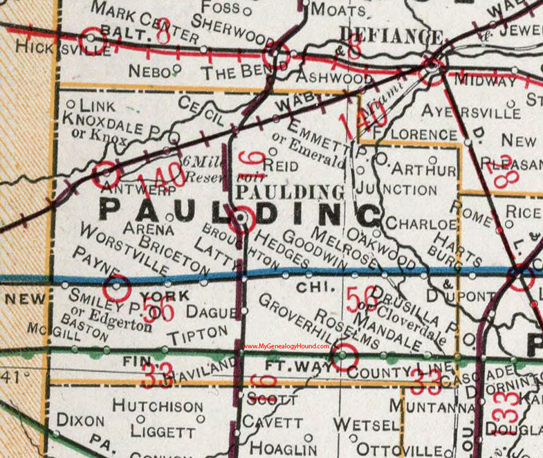
Paulding County, Ohio 1901 Map

Locations shown include: Antwerp * Arena * Arthur * Baston * Briceton * Broughton * Cecil * Charloe * County Line * Edgerton * Emerald * Emmett P O * Dague * Goodwin * Grover Hill * Haviland * Hedges * Junction * Knox * Knoxdale P O * Latty * Link * Mandale * McGill * Melrose * Oakwood * Paulding * Payne * Reid * Roselms * Smiley P O * Tipton * Worstville *
This Paulding County map is a portion of an 1901 Ohio map by Cram.
View additional Ohio Maps here: Ohio County Maps
County maps from other states can be viewed here: State County Maps
Use the links at the top right of this page to search or browse thousands of family biographies.