My Genealogy Hound
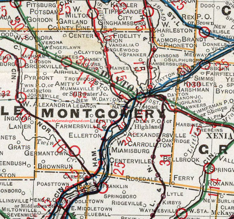
Montgomery County, Ohio 1901 Map

Locations shown include: Airhill * Alexandersville * Amity * Bachman * Brookville * Brown Run * Center * Centerville * Chambersburg * Clayton * Dayton * Dean P O * Dodson * Ellerton * Englewood * Farmersville * Fidelity * Germantown * Haines * Highland * Johnsons * Johnsville * Kinsey * Lebanon Junction * Liberty * Miamisburg * Mummaville P O * National Military Home * New Lebanon * North Dayton * Oak Ridge * Pyrmont * Rosedale * Spanker * Stillwater Junction * Sulphur Grove * Taylorsburg * Trotwood * Union * Vandalia * Verona * Vorhees * Wengerlawn * West Alexandria * West Carrollton * West Dayton *
This Montgomery County map is a portion of an 1901 Ohio map by Cram.
View additional Ohio Maps here: Ohio County Maps
County maps from other states can be viewed here: State County Maps
Additional Montgomery County resources: Montgomery County, Ohio History and Genealogy
Use the links at the top right of this page to search or browse thousands of family biographies.