My Genealogy Hound
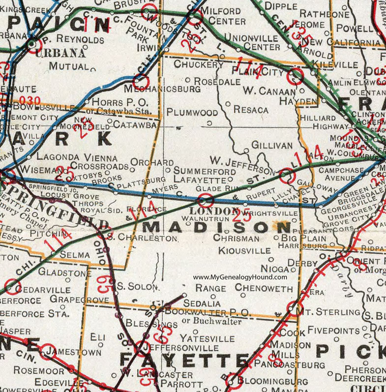
Madison County, Ohio 1901 Map

Locations shown include: Big Plain * Chenoweth * Chrisman * Gillivan * Glade Run * Kiousville * Lafayette * Lilly Chapel * London * Mount Sterling * Myers * Nioga * Plain City * Plumwood * Range * Resaca * Rosedale * Rupert * Sedalia * South Solon * Summerford * Walnut Run * West Canaan * West Jefferson * Wrightsville *
This Madison County map is a portion of an 1901 Ohio map by Cram.
View additional Ohio Maps here: Ohio County Maps
County maps from other states can be viewed here: State County Maps
Use the links at the top right of this page to search or browse thousands of family biographies.