My Genealogy Hound
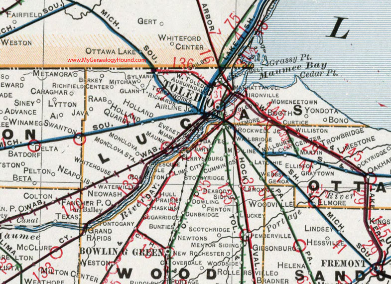
Lucas County, Ohio 1901 Map

Locations shown include: Airline Junction * Auburndale * Bailey * Berkey * Bono * Booth * East Toledo * Everett * Fancher P O * Glann * Holland * Holland Quarry * Ironville * Java * Manhattan Junction * Maumee * Miami * Mitchaw * Monclova * Monclova Station * Momeneetown * Neapolis * Neowash * Raab * Richards * Ritchfield Center * Sylvania * Toledo * Trilby * Waterville * West Toledo * Whitehouse * Yondota *
This Lucas County map is a portion of an 1901 Ohio map by Cram.
View additional Ohio Maps here: Ohio County Maps
County maps from other states can be viewed here: State County Maps
Use the links at the top right of this page to search or browse thousands of family biographies.