My Genealogy Hound
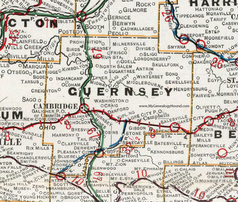
Guernsey County, Ohio 1901 Map

Locations shown include: Antrim * Birds Run * Birds Run Station * Bluebell * Boden * Bond * Brady * Buffalo * Byesville * Calihan * Cambridge * Campbells * Cassells * Claysville * Clio * Craig * Creighton * Cumberland * Danford * Derwent * Divide * Emlays * Fairview * Flat Ridge * Frisco * Galigher P O * Gibson * Guernsey * Gurnsey Mines * Harmony * Indian Camp * Johnsons * Kimbolton * Kipling * Londonderry * Lore City P O * Midway * Middlebourne * Milnersville * Moores * Nicholson * North Salem * Odell * Oldham * Pleasant City * Prohibition * Quaker City * Salesville * Senecaville * Skullfork * Sligo * Spencers * Stone Sid. * Sugar Tree * Tail Run * Tyner * Washington * Winterset
This Guernsey County map is a portion of an 1901 Ohio map by Cram.
View additional Ohio Maps here: Ohio County Maps
County maps from other states can be viewed here: State County Maps
Use the links at the top right of this page to search or browse thousands of family biographies.