My Genealogy Hound
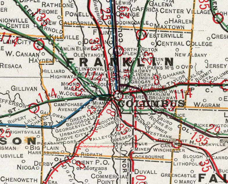
Franklin County, Ohio 1901 Map

Locations shown include: Ackerman * Alton* Amlin * Avenue * Bannon * Big Walnut * Blacklick * Brice * Briggsdale * Broadway * Campchase * Canal Winchester * Cassidys * Central College * Clinton (Clintonville) * Columbus * Cros * Dakrumm * Doneys * Dublin * Elmwood * Flint * Gahanna * Georgesville * Green Lawn * Grogan * Grounds * Grove City * Grove Port * Hayden * Harrisburg * Highway * Hilliard * Leonard * Linden * Lockbourne * Mapleheight * Marblecliff * Miami * Mifflinville * Milo * Miner * Mounds * New Albany * North Columbus * Olentangy * Ovid * Parks Meadow? * Pleasant Corners * Reeses * Ridpath * Rohrs Sid * Seagrave * Shadeville * Shepard * Taylor * Truro * Urbancrest * Valley Crossing * Westbank * West Columbus * Westerville * Worthington * Zimmer
This Franklin County map is a portion of an 1901 Ohio map by Cram.
View additional Ohio Maps here: Ohio County Maps
County maps from other states can be viewed here: State County Maps
Use the links at the top right of this page to search or browse thousands of family biographies.