My Genealogy Hound
Henry County, Missouri 1904 Map
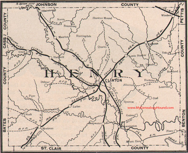
Locations shown include: Alberta, Blairstown, Brownington, Calhoun, Clinton, Coal, Deepwater, Delmar, Finey, Gaines, Hartwell, Hortense, Huntingdale, Ladue, Leesville, Lewis Station, Maurine, Montrose, Mount Zion, Noah, Norris, Petersburg, Piper, Quarles, Roseland, Shawnee Mound, Sparrow, Thrush, Urich, Windsor, Yolo
View additional Missouri Maps here: Missouri County Maps
County maps from other states can be viewed here: State County Maps
Additional Henry County resources: Henry County, Missouri History, Genealogy, and Maps
Use the links at the top right of this page to search or browse thousands of family biographies.