My Genealogy Hound
Franklin County, Missouri 1904 Map
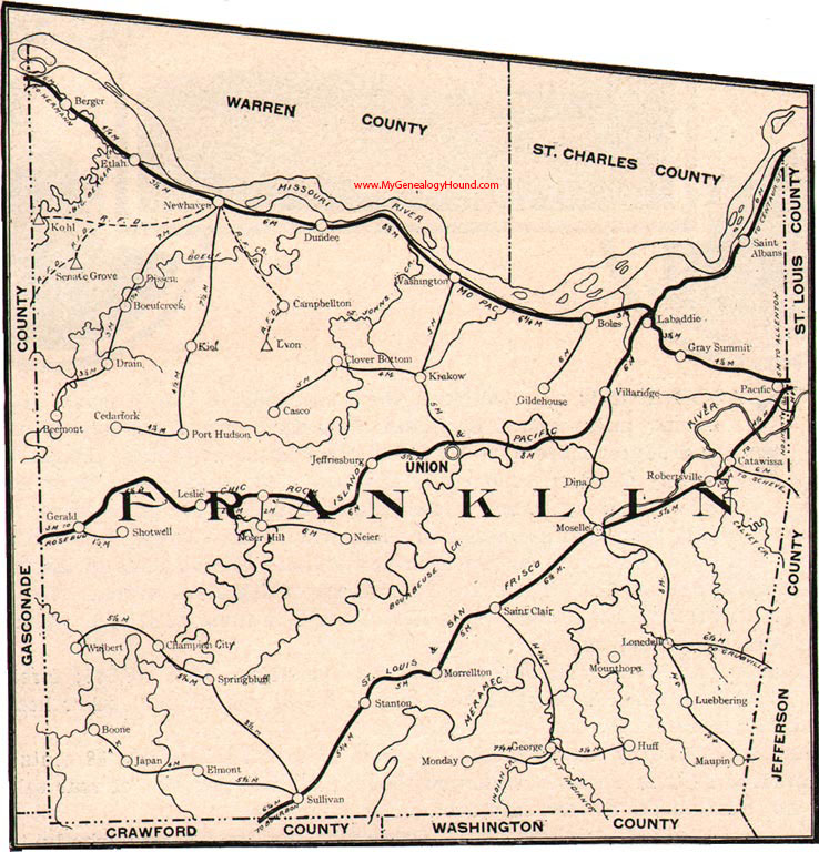
Locations shown include: Beemont, Berger, Boeufcreek, Boone, Campbellton, Casco, Catawissa, Cedarfork, Champion City, Clover Bottom, Dina, Dissen, Drain, Dundee, Elmont, Etlah, George, Gerald, Gildehouse, Gray Summit, Huff, Japan, Jeffriesburg, Kiel, Kohl, Krakow, Labaddie, Leslie, Lonedell, Luebbering, Lyon, Maupin, Monday, Morrellton, Moselle, Mounthope, Neier, New Haven, Noser Mill, Pacific, Port Hudson, Robertsville, Saint Albans, Saint Clair, Senate Grove, Shotwell, Springbluff, Stanton, Sullivan, Union, Villa Ridge, Walbert, Walbert, Washington
View family biographies from the 1888 History of Franklin County: Franklin County, Missouri
View additional Missouri Maps here: Missouri County Maps
County maps from other states can be viewed here: State County Maps
Additional Franklin County resources: Franklin County, Missouri History, Genealogy, and Maps
Use the links at the top right of this page to search or browse thousands of family biographies.