My Genealogy Hound
Muhlenberg County, Kentucky 1905 Map
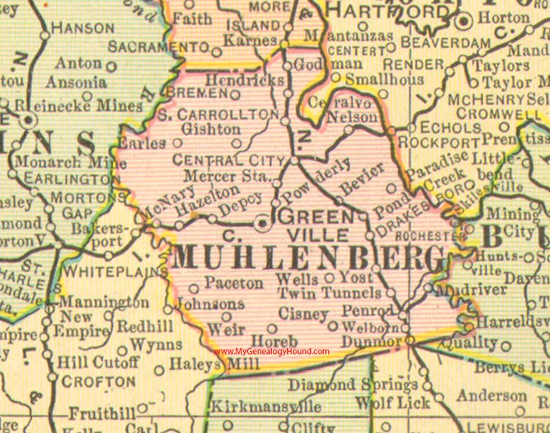
Locations shown include: Bevier, Bremen, Central City, Cisney, Depoy, Drakesboro, Dunmor, Earles, Gishton, Godman, Greenville, Hazelton, Hendricks, Horeb, McNary, Mercer Station, Mud River, Nelson, Paceton, Paradise, Penrod, Pond Creek, Powderly, Skilesville, South Carrollton, Twin Tunnels, Weir, Welborn, Wells, Yost
This a portion of a Kentucky map from Cram's Ideal Reference Atlas, 1905
View additional Kentucky Maps here: Kentucky County Maps
County maps from other states can be viewed here: State County Maps
Additional Muhlenberg County resources: Muhlenberg County, Kentucky History and Genealogy
Use the links at the top right of this page to search or browse thousands of family biographies.