My Genealogy Hound
Henderson County, Kentucky 1905 Map
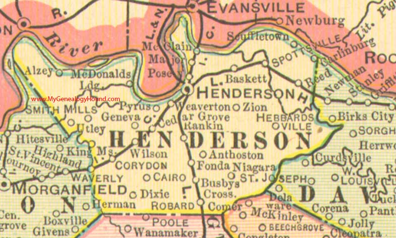
Locations shown include: Alzey, Anthoston, Baskett, Busbys Crossing, Cario, Carlinburg, Cedar Grove, Corydon, Dixie, Fonda, Geneva, Hebbardsville, Henderson, King Mills, Major, McClain, McDonald's Landing, Niagara, Posey, Pyrus, Rankin, Reed, Robards, Scuffletown, Smith Mills, Spottsville, Utley, Weaverton, Wilson, Zion
This a portion of a Kentucky map from Cram's Ideal Reference Atlas, 1905
View additional Kentucky Maps here: Kentucky County Maps
County maps from other states can be viewed here: State County Maps
Use the links at the top right of this page to search or browse thousands of family biographies.