My Genealogy Hound
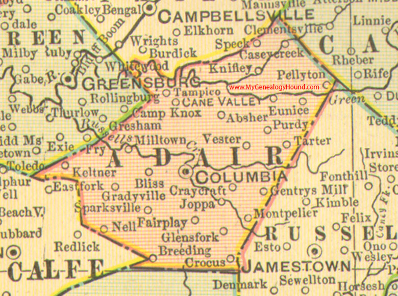
Adair County, Kentucky 1905 Map

Locations shown include: Absher, Bliss, Breeding, Cane Valley, Casey Creek, Columbia, Craycraft, Crocus, Eunice, Fairplay, Gentrys Mill, Glens Fork, Gradyville, Joppa, Keltner, Knifley, Milltown, Montpelier, Nell, Pellyton, Purdy, Sparksville, Speck, Tampico, Tarter, Vester
This a portion of a Kentucky map from Cram's Ideal Reference Atlas, 1905
View additional Kentucky Maps here: Kentucky County Maps
County maps from other states can be viewed here: State County Maps
Additional Adair County resources: Adair County, Kentucky History and Genealogy
Use the links at the top right of this page to search or browse thousands of family biographies.