My Genealogy Hound
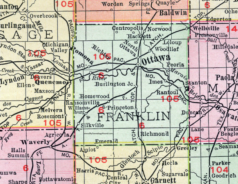
Franklin County, Kansas 1911 Map

Locations shown include: Burlington Junction, Centropolis, Hackett, Homewood, Imes, Lane, Leloup (Le Loup), North Ottawa, Norwood, Ottawa, Peoria, Pomona, Princeton, Ransomville, Rantoul, Richmond, Richter, Silkville, Wellsville, Williamsburg, Woodlief.
This Franklin County map is a portion of a 1911 Kansas map by Rand McNally.
View additional Kansas County Maps here: Kansas County Maps
County maps from other states can be viewed here: State County Maps
Use the links at the top right of this page to search or browse thousands of family biographies, historic maps, vintage photos and postcards.