My Genealogy Hound
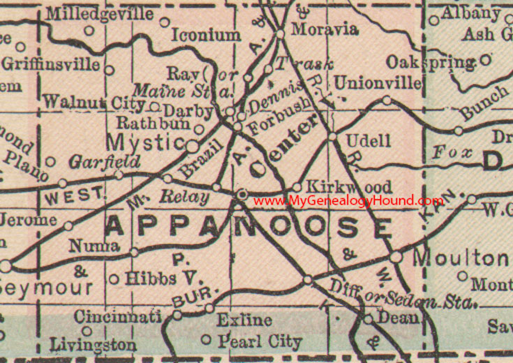
Appanoose County, Iowa 1905 Map

Locations shown include: Brazil, Centerville, Cincinnati, Darby, Dean, Dennis, Diff, Exline, Forbush, Garfield, Griffinsville, Hibbsville, Iconium, Jerome, Kirkwood, Livingston, Maine Station, Milledgeville, Moravia, Moulton, Mystic, Numa, Pearl City, Plano, Rathbun, Ray, Relay, Sedan Station, Trask, Udell, Unionville, Walnut City
This is a portion of a Iowa map by The Matthews-Northrup Co., dated 1899, published in 1905 within The Peerless Atlas.
View additional Iowa Maps here: Iowa County Maps
County maps from other states can be viewed here: State County Maps
Additional Appanoose County resources: Appanoose County, Iowa History and Genealogy
Use the links at the top right of this page to search or browse thousands of family biographies.