My Genealogy Hound
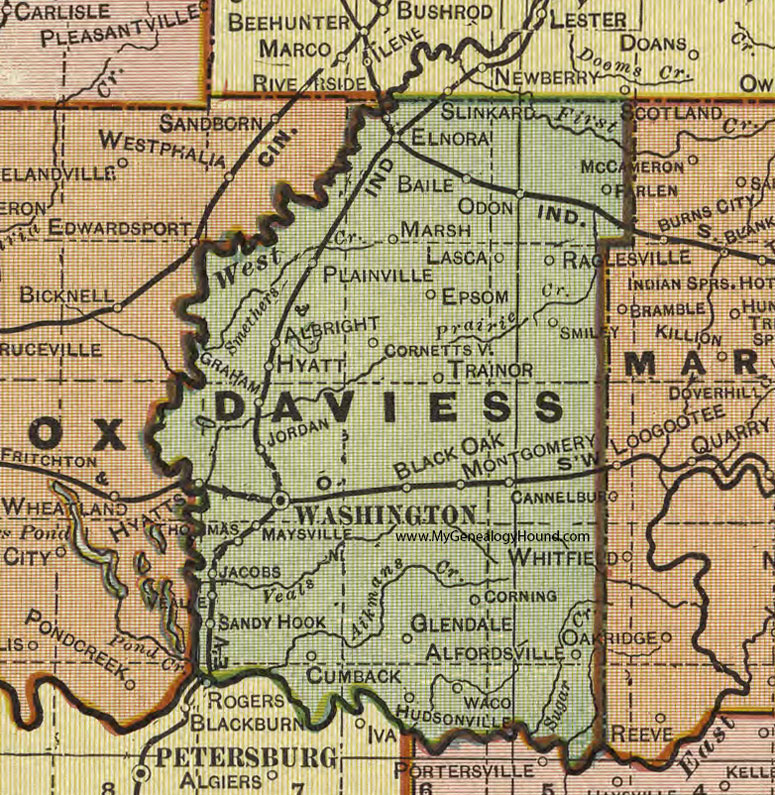
Daviess County, Indiana 1908 Map

Locations shown include: Albright, Alfordsville, Baile, Black Oak, Cannelburg, Cornettsville, Corning, Cumback, Elnora, Epsom, Farlen, Glendale, Graham, Hudsonville, Hyatt, Jacobs, Jordan, Lasca, Marsh, Maysville, Montgomery, Odon, Plainville, Raglesville, Sandy Hook, Smiley, Thomas, Trainor, Waco, Washington
This a portion of a map by Geo. A. Ogle & Co., 1908
View additional Indiana Maps: Indiana County Maps
County maps from other states can be viewed here: State County Maps
Additional Daviess County resources: Daviess County, Indiana History and Genealogy
Use the links at the top right of this page to search or browse thousands of family biographies.