My Genealogy Hound
Winnebago County, Illinois 1870 Map
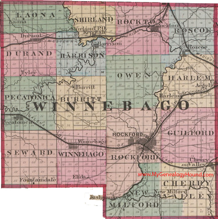
Locations shown include: Argyle, Burritt, Cherry Valley, Durand, Elida, Fountaindale, Harlem, Harrison, Kepotah, Kishwaukee, Laona, New Milford, Pecatonica, Rockford, Rockton, Roscoe, Shirland, Tyler, Winnebago
The names shown in all caps are the names of the townships
This a portion of a map from Atlas of Illinois, by Warner & Beers, 1870
View additional Illinois Maps here: Illinois County Maps
County maps from other states can be viewed here: State County Maps
Use the links at the top right of this page to search or browse thousands of family biographies.