My Genealogy Hound
Pike County, Illinois 1870 Map
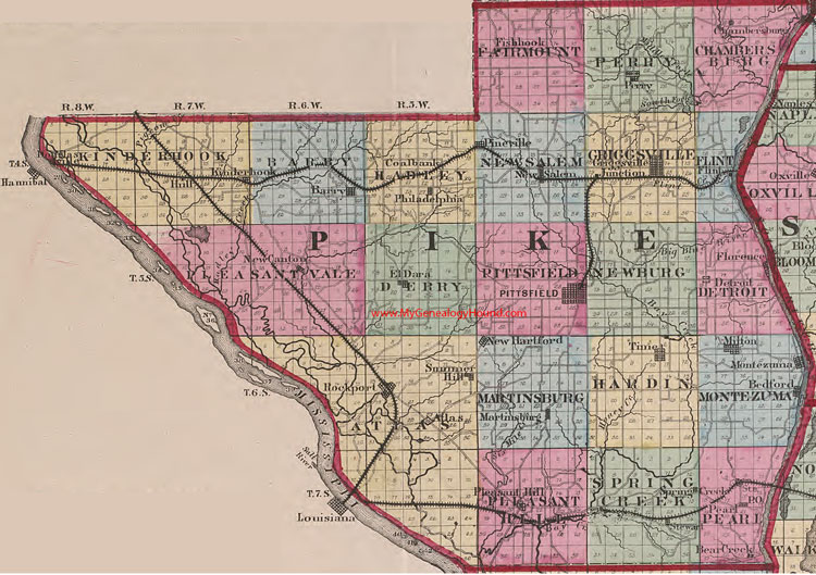
Locations shown include: Atlas, Barry, Bear Creek, Bedford, Chambersburg, Coalbank, Detroit, Douglasville, El Dara, Fishhook, Flint, Florence, Griggsville, Hull, Junction, Kinderhook, Martinsburg, Milton, Montezuma, New Canton, New Hartford, New Salem, Pearl, Perry, Philadelphia, Pineville, Pittsfield, Pleasant Hill, Rockport, Spring Creek, Stewart, Summer Hill, Time
The names shown in all caps are the names of the townships
This a portion of a map from Atlas of Illinois, by Warner & Beers, 1870
View additional Illinois Maps here: Illinois County Maps
County maps from other states can be viewed here: State County Maps
Additional Pike County resources: Pike County, Illinois History, Genealogy, and Maps
Use the links at the top right of this page to search or browse thousands of family biographies.