My Genealogy Hound
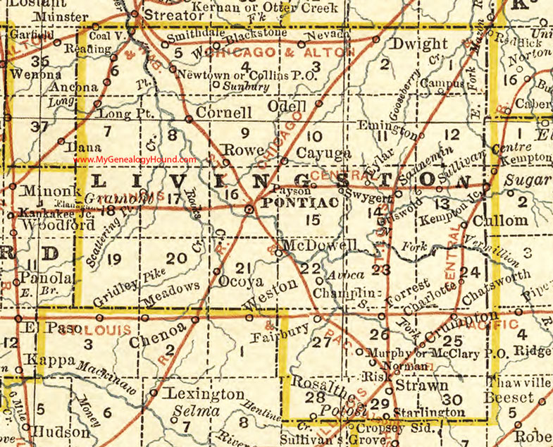
Livingston County, Illinois 1881 Map

Locations shown include: Ancona, Avoca, Blackstone, Campus, Cayuga, Champlin, Charlotte, Chatsworth, Coalville, Cornell, Crumpton, Dwight, Emington, Eylar, Fairbury, Flanagan Junction, Forrest, Griswold, Long Point, McClary, McDowell, Murphy, Nevada, Norman, Ocoya, Odell, Payson, Pontiac, Potosi, Reading, Risk, Rosalthe, Rowe, Saunemin (Sanneman), Smithdale, Starlington, Strawn, Sullivan Centre, Swygert
This a portion of a map by Rand McNally, 1881.
View additional Illinois Maps here: Illinois County Maps
County maps from other states can be viewed here: State County Maps
Use the links at the top right of this page to search or browse thousands of family biographies, historic maps, and vintage photos and postcards.