My Genealogy Hound
Sevier County, Arkansas 1889 Map
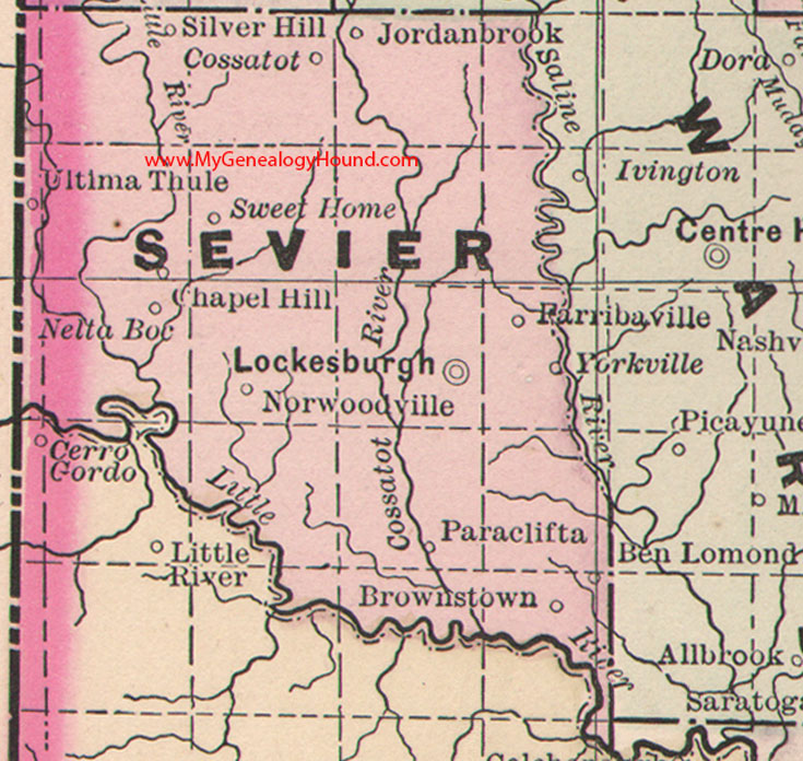
Locations shown include: Ben Lomand, Brownstown, Chapel Hill, Cossatot, Farribaville, Jordanbrook, Lockesburg (Lockesburgh), Nelta Boc, Norwoodville, Paraclifta, Silver Hill, Sweet Home, Ultima Thule, Yorkville
This is a portion of a Arkansas map published by Bradley, circa 1889.
View family biographies from the 1890 History of Sevier County: Sevier County, Arkansas
View additional Arkansas Maps here: Arkansas County Maps
County maps from other states can be viewed here: State County Maps
Additional Sevier County resources: Sevier County, Arkansas History, Genealogy, and Maps
Use the links at the top right of this page to search or browse thousands of family biographies.