My Genealogy Hound
Pulaski County, Arkansas 1898 Map
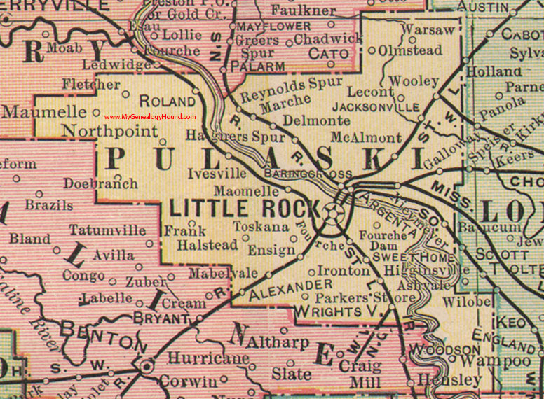
Locations shown include: Alexander, Argenta, Baring Cross, Delmonte, Doebranch, Ensign, Fletcher, Fourche Dam, Frank, Galloway, Hagners Spur, Halstead, Higginsville, Ironton, Ivesville, Jacksonville, Lecont, Little Rock, Mablevale, Marche, Maumelle, McAlmont, Nievmeyer, Northpoint, Olmstead, Parkers Store, Reynolds Spur, Roland, Sweet Home, Toskana, Warsaw, Wrightsville
This is a portion of a Arkansas map published by George F. Cram in 1898.
View family biographies from the 1889 History of Pulaski County: Pulaski County, Arkansas
View additional Arkansas Maps here: Arkansas County Maps
County maps from other states can be viewed here: State County Maps
Additional Pulaski County resources: Pulaski County, Arkansas History, Genealogy, and Maps
Use the links at the top right of this page to search or browse thousands of family biographies.