My Genealogy Hound
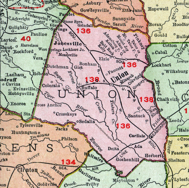
Union County, South Carolina, 1911 Map

Locations shown include: Ada, Adam, Adamsburg P O, Bald Rock, Bonham, Buffalo, Carlisle, Colerain, Crawford, Crosskeys (Cross Keys), Delta, Elzie, Faucett, Gist, Goshenhill (Goshen Hill), Gregory, Herbert, Jonesville, Kelly, Kelton, Lockhart Junction, Meansville, Monarch, Mount Joy, Mount Tabor P O, Neal Shoals, Pinkney, Pride, Santuck, Sedalia, Tabor, Union, West Springs.
This Union County map is a portion of a 1911 South Carolina map by Rand McNally.
View additional South Carolina Maps here: South Carolina County Maps
County maps from other states can be viewed here: State County Maps
Use the links at the top right of this page to search or browse thousands of family biographies, historic photos and vintage postcards.