My Genealogy Hound
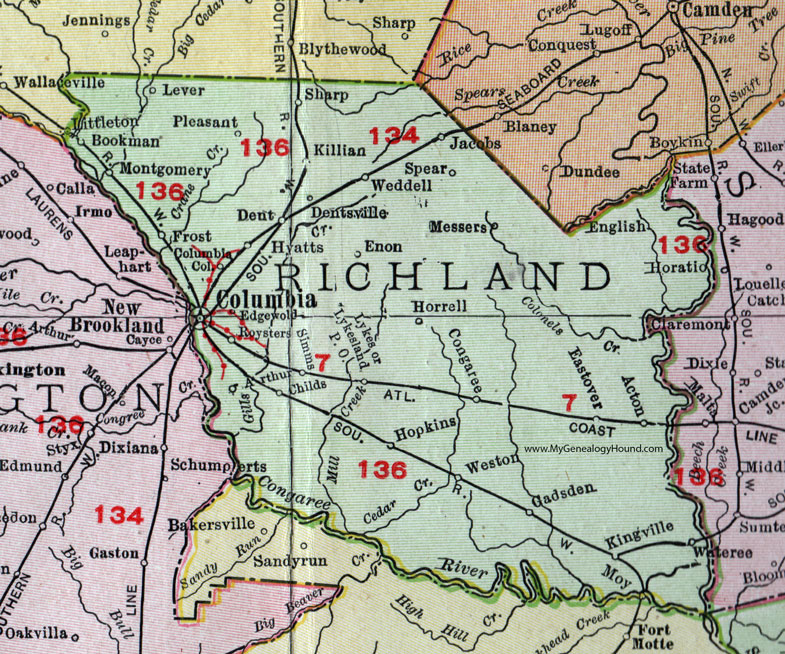
Richland County, South Carolina, 1911 Map

Locations shown include: Acton, Arthur, Bookman, Childs, Columbia, Columbia College, Congaree, Dent, Dentsville, Eastover, Edgewold, English, Enon, Frost, Gadsden, Hopkins, Horatio, Horrell, Hyatts, Jacobs, Killian, Kingville, Lever, Littleton, Lykes, Lykesland P O, Messers, Montgomery, Moy, Pleasant, Roysters, Sharp, Simms, Spear, Weddell, Weston.
This Richland County map is a portion of a 1911 South Carolina map by Rand McNally.
View additional South Carolina Maps here: South Carolina County Maps
County maps from other states can be viewed here: State County Maps
Use the links at the top right of this page to search or browse thousands of family biographies, historic photos and vintage postcards.