My Genealogy Hound
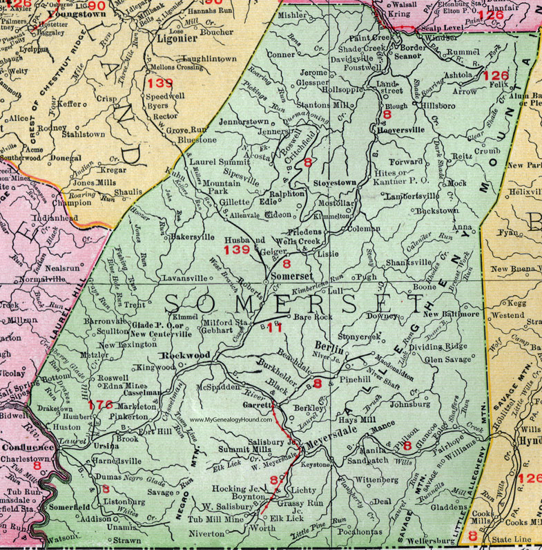
Somerset County, Pennsylvania 1911 Map

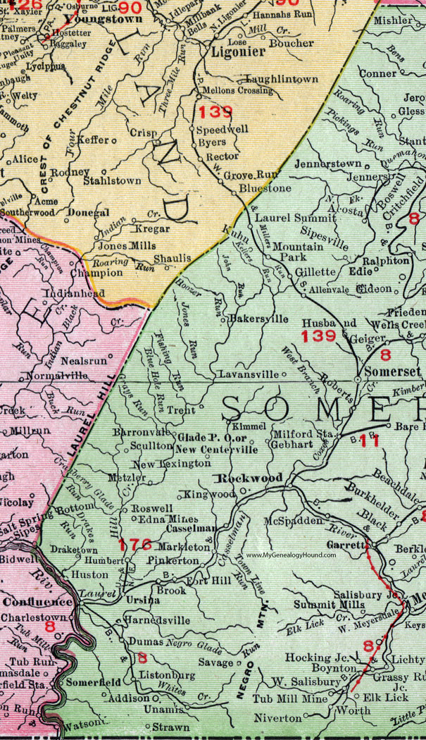
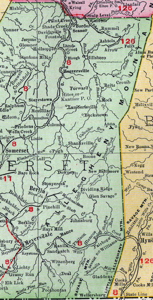
Locations shown include: Acosta * Addison * Allenvale * Anna * Arrow * Ashtola * Bakersville * Bare Rock * Barronvale * Beachdale * Berkley * Berlin * Black * Blough * Boone * Border * Boswell * Boynton * Brook * Buckstown * Burkhelder * Casselman * Coleman * Confluence * Conner * Critchfield * Crumb * Davidsville * Deal * Dividing Ridge * Downey * Draketown * Dumas * Edie * Edna Mines * Elk Lick * Fairhope * Felix * Foley * Fort Hill * Forward * Foustwell * Friedens * Garrett * Gebhart * Gideon * Gieger * Gillette * Gladdens * Glade P O * Glencoe * Glen Savage * Glessner * Grassy Run * Harnedsville * Hays Mill * Hillsboro * Hites * Hocking Junction * Hollsopple * Hooversville * Humbert * Husband * Huston * Jenners * Jennerstown * Jerome * Johnsburg * Kantner P O * Keystone * Kimmel * Kimmelton * Kingwood * Kuhn * Lambertsville * Landstreet * Laurel Summit * Lavansville * Lichty * Listie * Listonburg * Lull * Macdonaldton * Mance * Manila * Markleton * McSpadden * Metzler * Meyersdale * Milford Station * Mishler * Mock * Mostollar * Mountain Park * New Baltimore * New Centerville * New Lexington * Niver Junction * Niver Shaft * Niverton * Paint Creek * Philson * Pinehill (Pine Hill) * Pinkerton * Pocahontas * Pugh * Ralphton * Reitz * Roberts * Rockwood * Roswell * Rummel * Salisbury Junction * Sandpatch (Sand Patch) * Savage * Scullton * Seanor * Shade Creek * Shanksville * Sipesville * Somerfield * Somerset * Stantons Mill * Stonycreek (Stony Creek) * Stoyestown (Stoystown) * Strawn * Summit Mills * Tub Mill Mine * Trent * Unamis * Ursina * Wellersburg * Wells Creek * West Meyersdale * West Salisbury * Williams * Windber * Windsor * Wittenberg * Worth *
This Somerset County map is a portion of an 1911 Pennsylvania map by Rand McNally. See the enlarged map views below.

An enlarged view of western Somerset County, Pennsylvania on an 1911 map by Rand McNally.

An enlarged view of eastern Somerset County, Pennsylvania on an 1911 map by Rand McNally.
View additional Pennsylvania Maps here: Pennsylvania County Maps
County maps from other states can be viewed here: State County Maps
Use the links at the top right of this page to search or browse thousands of family biographies.