My Genealogy Hound
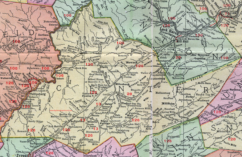
Centre County, Pennsylvania 1911 Map

Locations shown include: Aaronsburg * Aqua * Beech * Bellefonte * Benore P O * Blanchard P O * Bloomsdorf * Boalsburg * Boynton * Briarly * Buffalorun (Buffalo Run) * Butts * Cato * Center Hall (Centre Hall) * Centerhill (Center Hill) (Centre Hill) * Clarence P O * Clarks * Coburn * Coleville * Colyer * Curtin * Dale Summit * Dunkles * Eagleville Station * Fairbrook * Farmers Mills * Fiedler * Fillmore * Fleming P O * Fountain * Fowler * Gatesburg * Gillintown * Gorton * Gregg * Gum Stump * Hannah * Hecla Park * Hostler * Houserville * Howard * Hublersburg * Hunters Park * Huston * Ingleby * Julian * Krumrine * Lemont * Linden Hall * Loveville * Madisonburg * Mapes * Martha Furnace P O * Martha Station * Mattern Junction * Milesburg * Millheim * Mingoville * Monument * Morengo * Morris * Moshannon P O * Mountain Eagle * Musser * Nittany * Oakhall Station * Orviston * Osceola Junction * Paddy Mountain * Panther * Penns Cave * Pennhall (Penn Hall) * Per Se * Peru * Philipsburg * Pinegrove Mills (Pine Grove Mills) * Pleasant Gap * Pleasant Gap Station * Port Matilda * Potters Mills * Powelton * Reale Station * Rebersburg * Retort * Rhoads * Rising Spring * Rock Run * Rockspring * Romola * Runville P O * Sandy Ridge * School House * Scotia * Shingletown * Smullton * Snow Shoe * Snow Shoe Int. * Snow Shoe Station * Snuffton * Snydertown * Sober P O * Spring Mills * Stark * State College * Steiners * Stevens * Stormstown * Strubles * Summit * Tusseyville * Unionville * Waddle * Walker * Wingate P O * Wolfs Store * Woodward * Yarnell * Zerby Station * Zion *
This Centre County map (misspelled as Center County) is a portion of an 1911 Pennsylvania map by Rand McNally. See the enlarged map views below.

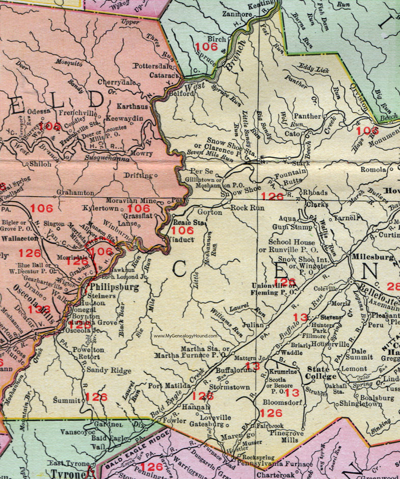
An enlarged view of western Centre County, Pennsylvania on an 1911 map by Rand McNally.

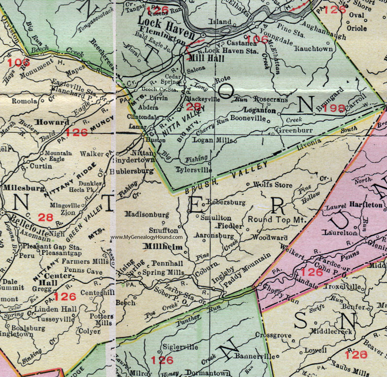
An enlarged view of eastern Centre County, Pennsylvania on an 1911 map by Rand McNally.
View additional Pennsylvania Maps here: Pennsylvania County Maps
County maps from other states can be viewed here: State County Maps
Use the links at the top right of this page to search or browse thousands of family biographies.