My Genealogy Hound
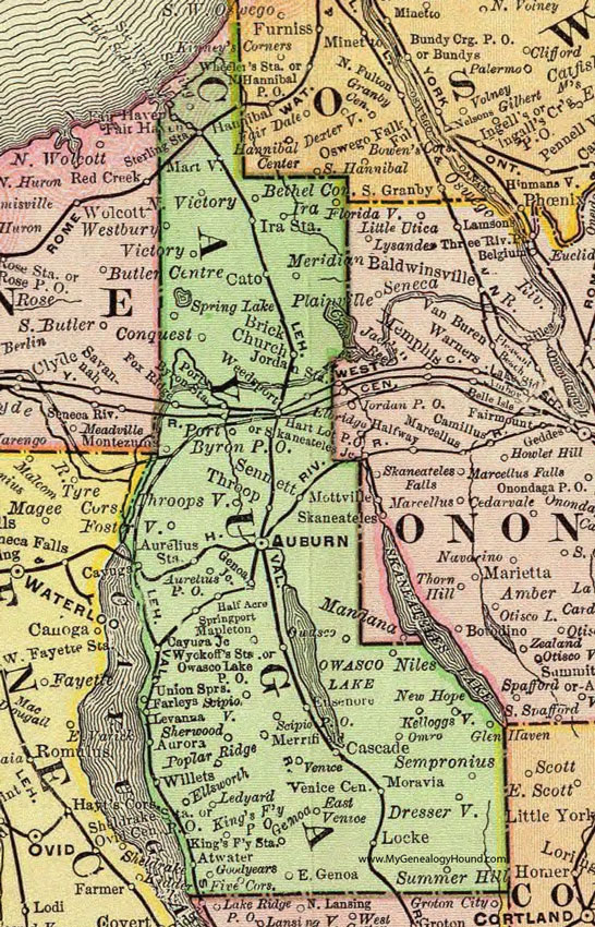
Cayuga County, New York 1897 Map

Locations shown include: Atwater * Auburn * Aurelius P O * Aurelius Station * Aurora * Bethel Corners * Brick Church * Cascade * Cato * Cayuga Junction * Conquest * Dresserville * East Genoa * East Venice * Ellsworth * Ensenore * Fair Haven * Farleys * Five Corners * Floridaville * Fosterville * Fox Ridge * Genoa Junction * Glen Haven * Goodyears * Half Acre * Ira Station * Kelloggsville * King's Ferry P O * King's Ferry Station * Ledyard * Levanna * Locke * Mapleton * Martville * Meridian * Merrifield * Montezuma * Moravia * New Hope * Niles * North Fair Haven * North Victory * Omro * Owasco * Owasco Lake P O * Poplar Ridge * Port Byron P O * Port Byron Station * Scipio P O * Scipioville * Sempronius * Sennett * Sherwood * Spring Lake * Springport * Sterling * Sterling Station * Sterling Valley * Summer Hill * Throop * Throopsville * Union Springs * Venice * Venice Center * Victory * Weedsport * Willets * Wyckoffs Station *
This Cayuga County map is a portion of an 1897 New York map by Rand McNally.
View additional New York Maps here: New York County Maps
County maps from other states can be viewed here: State County Maps
Use the links at the top right of this page to search or browse thousands of family biographies.