My Genealogy Hound
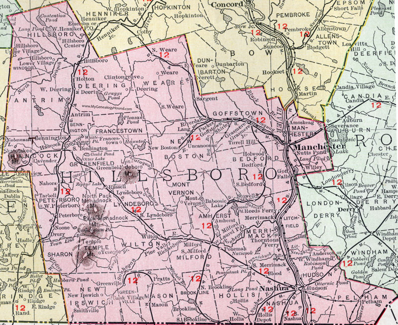
Hillsborough County, New Hampshire Map, 1912

Locations shown include: Amherst, Amoskeag, Antrim, Baboosic Lake, Bank Village, Bedford, Bennington, Blood, Brookline, Cavender, Clintongrove (Clinton Grove), Deering, Drury, East Deering, East Milford, East Weare, Elmwood, Everett, Francestown, Goffs Falls, Goffstown, Grasmere, Grasmere Junction, Greenfield, Greenville, Hancock, Hillsboro (Hillsborough), Hillsboro Center, Hillsboro Lower Village, Hillsboro Upper Village, Hollis, Hollis Depot, Holton, Holwood, Hudson, Lang, Laurel, Litchfield, Lyndeboro (Lyndeborough), Manchester, Mason, Massabesic, Merrimack, Milford, Mont Vernon, Nahors, Nashua, New Boston, New Ipswich, Noone, North Brookline, North Weare, Nutts Pond, Parker, Pelham, Petersboro (Peterborough), Pine Valley, Ponemah, Pratts, Reeds Ferry, Richardson, Riverdale, Russell, Sargent, Shirley, Smithville, South Bedford, South Bennington, South Brookline, South Lyndeboro, South Merrimack, South Milford, South Nashua, Stowell, Tarbell, Temple, Thorntons Ferry, Tirrell Hill, Uncanoonuc, Weare, West Deering, West Hollis, West Petersboro, Willey, Wilton.
This Hillsborough County map is a portion of a 1912 New Hampshire map by Rand McNally.
View additional New Hampshire maps here: New Hampshire County Maps
County maps from other states can be viewed here: State County Maps
Use the links at the top right of this page to search or browse thousands of family biographies.