My Genealogy Hound
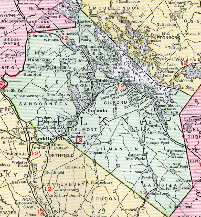
Belknap County, New Hampshire Map, 1912

Locations shown include: Alton, Alton Bay, Ames, Barnstead, Bear Island, Belknap Point, Belmont, Belmont Junction, Brookhurst, Buckley, Center Barnstead, Center Harbor, East Tilton P. O., Gardners Grove, Gilford, Gilmanton, Gilmanton Iron Works, Glendale, Greystone, Keewaydin, Laconia, Lakeport, Lake Shore Park, Lily Pond, Lochmere, Loon Cove, Meadowbrook, Meredith, Meredith Center, Mount Major, New Hampton, North Barnstead, North Sanbornton, Sanbornton, Smiths Point, South Barnstead, Spring Haven, Summit, Terrace Hill, The Weirs, Tilton, West Alton, Winnisquam, Winona, Woodlands.
This Belknap County map is a portion of a 1912 New Hampshire map by Rand McNally.
View additional New Hampshire maps here: New Hampshire County Maps
County maps from other states can be viewed here: State County Maps
Use the links at the top right of this page to search or browse thousands of family biographies.