My Genealogy Hound
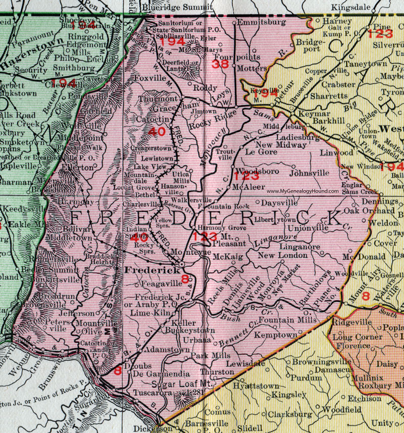
Frederick County, Maryland 1911 Map

Locations shown include: Adamstown * Araby P O * Bartholows * Bethel * Bolivar * Braddock Heights * Broadrun (Broad Run) * Brunswick * Buckeystown * Burkittsville * Catoctin * Charlesville * Creagerstown * Daysville * Deerfield * De Garmendia * Dennis * Doubs * Ellerton * Emmitsburg * Eyler * Feagaville * Fourpoints * Fountain Mills * Fountain Rock * Foxville * Frederick * Frederick Junction * Garfield * Graceham * Gross * Harmony * Harmony Grove * Ijamsville * Indian Springs * Jefferson * Jimtown * Johnsville * Keller * Kemptown * Knoxville * Ladiesburg * Lake View * Lander P O * Lantz P O * Le Gore * Lewistown * Libertytown * Lime Kiln * Linganore * Locust Grove * Loys * McAleer * McDonald * McKaig * Middleburg * Middlepoint * Middletown * Monrovia * Montevue * Motters * Mountaindale * Mount Pleasant * Mount Saint Marys * Mountville * Myersville * New London * New Market * New Midway * Oak Orchard * Olive * Park Mills * Petersville * Plane No. 4 * Pleasant Walk * Point of Rocks P O * Reels Mills * Retreat Grove * Rocky Ridge * Rocky Springs * Roddy * Sabiliasville * Sanitorium * State Sanitorium P O * Sugarloaf * Thurmont * Thurston * Troutville * Tuscarora * Unionville * Urbana * Walkersville * Washington Junction * Weldon * Wenners * Wolfsville * Wood * Woodsboro * Yellow Springs *
This Frederick County map is a portion of a 1911 Maryland map by Rand McNally.
View additional Maryland Maps here: Maryland County Maps
County maps from other states can be viewed here: State County Maps
Use the links at the top right of this page to search or browse thousands of family biographies.