My Genealogy Hound
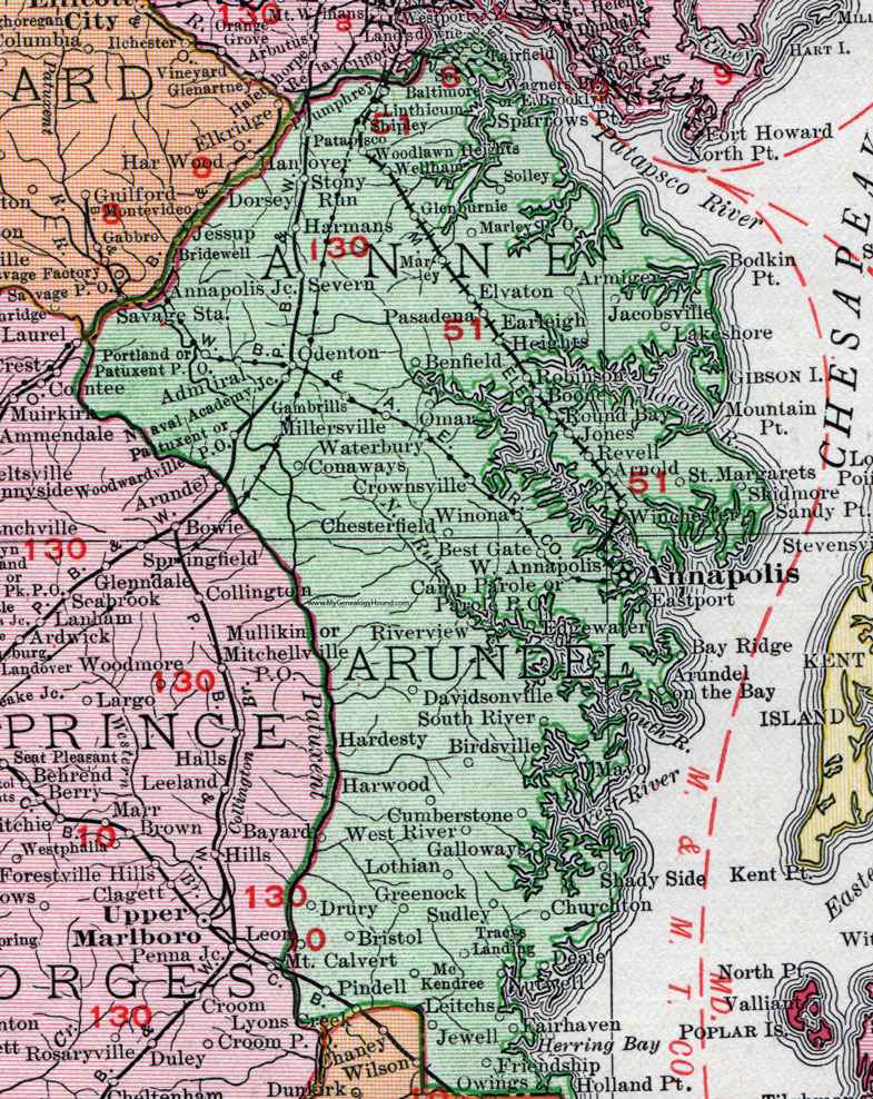
Anne Arundel County, Maryland 1911 Map

Locations shown include: Admiral * Annapolis * Annapolis Junction * Armiger * Arnold * Arundel on the Bay * Bay Ridge * Benfield * Best Gate * Birdsville * Boone * Bridewell * Bristol * Brooklyn * Camp Parole * Chesterfield * Churchton * Conaways * Crisp * Crownsville * Cumberstone * Davidsonville * Deale * Dorsey * Drury * Earleigh Heights * East Brooklyn * Eastport * Edgewater * Elvaton * Fairfield * Fairhaven * Friendship * Galloways * Gambrills * Glen Burnie (Glenburnie) * Greenock * Hanover * Hardesty * Harmans * Harwood * Holland Point * Jacobsville * Jessup * Jewell * Jones * Lakeshore * Leitchs * Leon * Linthicum * Lothian * Lyons Creek * Marley * Marley P O * Mayo * McKendree * Millersville * Mountain Point * Nutwell * Odenton * Omar * Owings * Parole P O * Pasadena * Patapsco * Patuxent * Patuxent P O * Pindell * Portland * Pumphrey * Revell * Riverview * Robinson * Round Bay * Saint Margarets * Sandy Point * Severn * Shady Side * Shipley * Skidmore * Solley * South Baltimore * South River * Sparrows Point * Stony Run * Sudley * Tracys Landing * Wagners Point * Waterbury * Wellham * West Annapolis * West River * Winchester * Winona * Woodlawn Heights * Woodwardville P O *
This Anne Arundel County map is a portion of a 1911 Maryland map by Rand McNally.
View additional Maryland Maps here: Maryland County Maps
County maps from other states can be viewed here: State County Maps
Use the links at the top right of this page to search or browse thousands of family biographies.