My Genealogy Hound
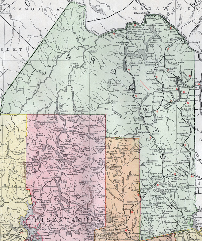
Aroostook County, Maine, 1912 Map

(See enlarged portions of this map below.)
Locations shown include: Acadia, Allegash, Ashland, Bancroft, Belvedere, Benedicta, Bennetts, Blackstone, Blackwater, Blaine, Bouchard, Bradburys, Bridgewater Center, Burleigh P. O., Canibas, Caribou, Cary, Carys Mills, Cherokee, Cleveland, Crouseville, Crystal, Daggett, Daigle, Dickey, Dudley, Dyer Brook, Eagle Lake, East Lyndon, Easton, Fairmount, Fish River Junction, Fort Fairfield, Fort Fairfield Junction, Fort Kent, Fort Kent Mills, Frenchville, Glenwood, Goldenridge, Goodrich, Goodwin, Grand Isle, Grimes, Griswold, Hamlin, Hanford, Harvey, Haynesville, Haywood, Hersey, Hillman, Hills, Hodgdon, Houlton, Howe Brook, Island Falls, Hurd, Jemtland, Keegan, Limestone, Linneus, Littleton, Lombards Landing, Ludlow, Macwahoc, Madawaska, Maplegrove, Mapleton, Mars Hill, Martins, Masardis, Maysville, Michaud, Monarda, Monticello, Moro, Morris, Nelson, New Limerick, New Sweden, New Sweden Station, Nixon, North Amity, North Bancroft, Notre Dame, Oakfield, Oakfield Junction, Ogren, Orient, Oxbow, Parent, Parkhurst, Patten Junction, Perham, Phair P. O., Pierre, Plaisted, Portage, Presque Isle, Roberts, Robie, Robinsons, Rockabema, Roxie, Selden, Shaw, Sheridan, Sherman Mills, Sherman P. O., Sinclair, Skerry, Smyrna Mills, Soldier Pond, South Bancroft, Spaulding, Squa Pan, St. Agatha, St. Croix, St. David, St. Francis, St. John, St. Luce, State Road, Stockholm, Upper Frenchville P. O., Van Buren, Violette, Walker, Wallagrass, Washburn, Weeksboro, Westfield, Westmanland, Weston, Wheelock, Wiley Road, Winterville, Winterville P. O., Wytopitlock.
This Aroostook County map is a portion of a 1912 Maine map by Rand McNally.

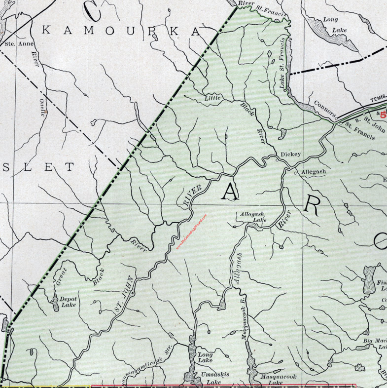
Map of the northwestern portion of Aroostook County, Maine.

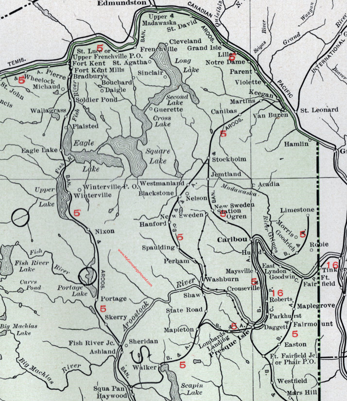
Map of the northeastern portion of Aroostook County, Maine.

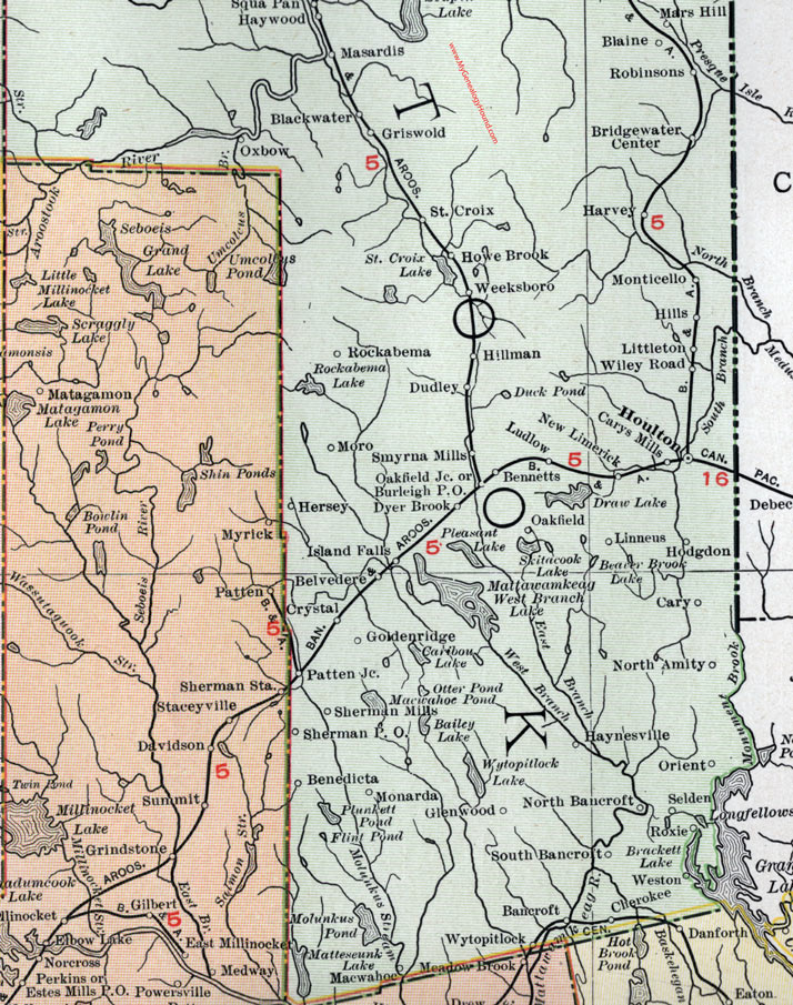
Map of the southern portion of Aroostook County, Maine.
View additional Maine Maps here: Maine County Maps
County maps from other states can be viewed here: State County Maps
Use the links at the top right of this page to search or browse thousands of family biographies.