My Genealogy Hound
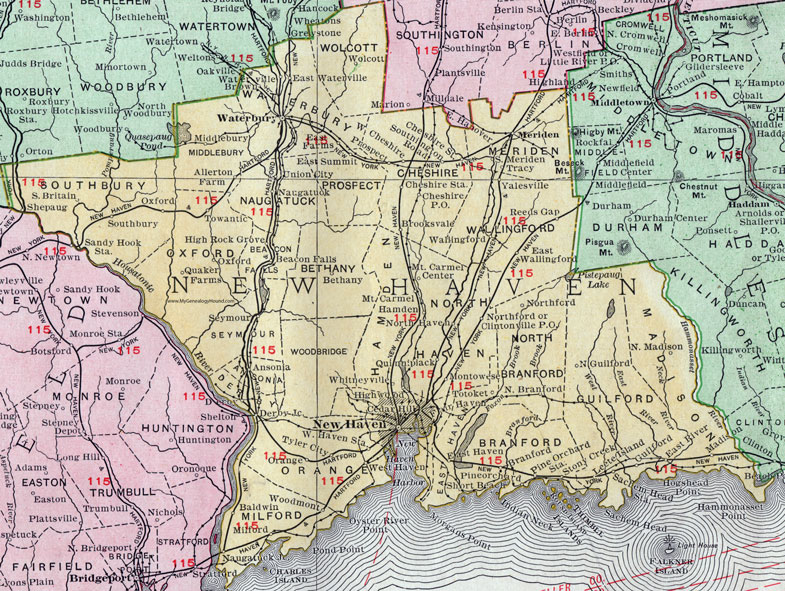
New Haven County, Connecticut, 1911 Map

Locations shown include: Allerton Farm, Ansonia, Baldwin, Beacon Falls, Bethany, Branford, Brookwvale, Brown, Cedar Hill, Cheshire, Cheshire P O, Cheshire Station, Clintonville P O, Derby, Derby Junction, East Farms, East Hanover, East Haven, East River, East Summit, East Wallingford, East Waterville, Fair Haven, Hamden, High Rock Grove, Guilford, Highwood, Leete Island, Madison, Meriden, Middlebury, Milford, Montowese, Mount Carmel, Mount Carmel Center, Naugatuck, New Haven, North Branford, Northford, North Guilford, North Haven, North Madison, Orange, Oxford, Pineorchard (Pine Orchard), Pine Orchard Station, Prospect, Quaker Farms, Quinnipiack, Reeds Gap, Sachem Head Station, Seymour, Shepaug, Short Beach, South Britian, Southbury, South Meriden, Stony Creek, Totoket, Towantic, Tracy, Tyler City, Union City, Wallingford, Waterbury, Waterville, West Haven, West Haven Station, Whitneyville, Wolcott, Yalesville.
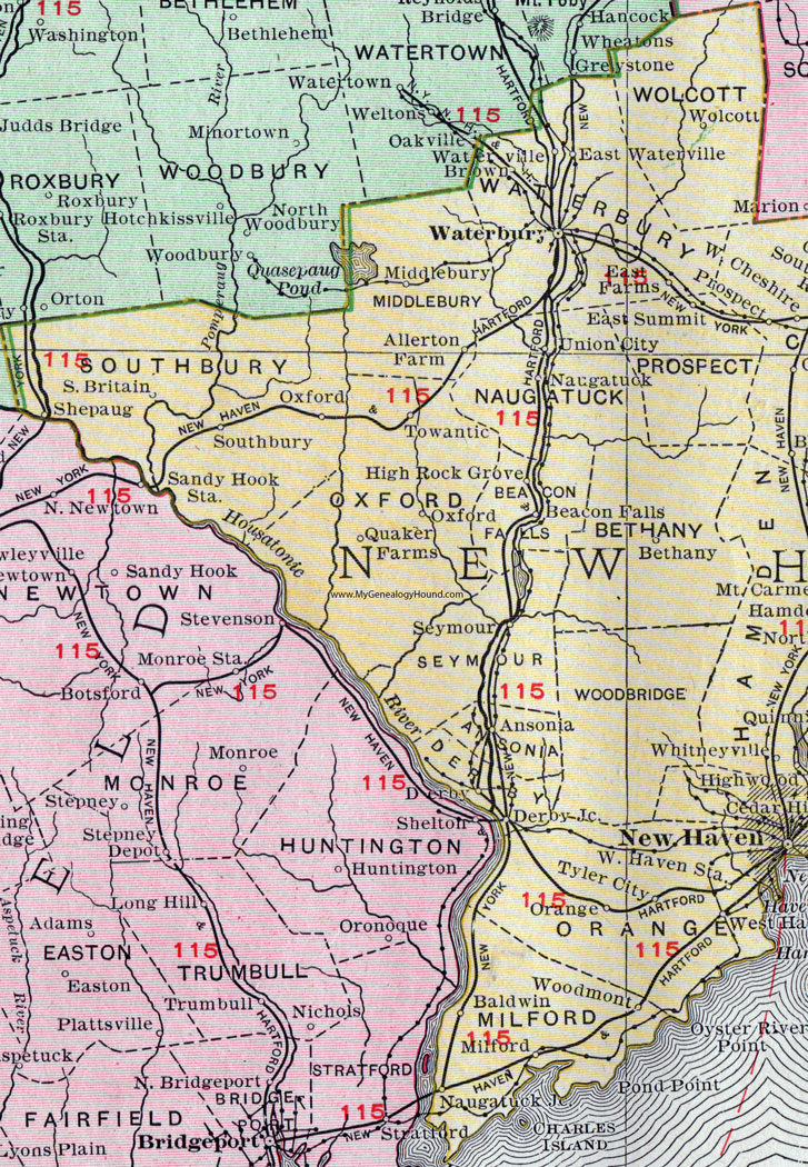
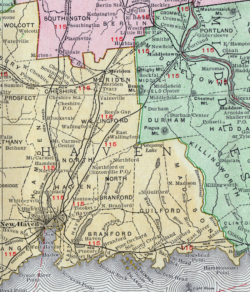
See the enlarged views below.

An enlarged view of the western half of New Haven County, Connecticut.

An enlarged view of the eastern half of New Haven County, Connecticut.
This New Haven County map is a portion of a 1911 Connecticut map by Rand McNally.
View additional Connecticut Maps here: Connecticut County Maps
County maps from other states can be viewed here: State County Maps
Use the links at the top right of this page to search or browse thousands of family biographies.